Search on this blog

Specialized Studies

Cemetery Studies

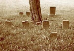
Marked cemeteries may have visible above ground elements, including grave markers, memorials, plantings, or other landscape features. Some of these elements may exist even after markers are removed from a cemetery. Historic documentation for known cemeteries often involves a number of measures that are specific to the characteristics of the cemetery property and the desired preservation goals.

Cemetery identification and delineation surveys are a specialized type of archeological investigation that are focused on locating and documenting cemeteries that are "lost" (forgotten, overgrown, or unmarked) or "abandoned" (no longer maintained or used for burials). The presence of small cemeteries can be established through a combination of historical research using deeds, historic maps, and aerial photographs, and verified through fieldwork.

Cemetery delineation, conducted by non-invasive geophysical methods or by removing surface soils to determine the presence of grave shafts, are effective to determine the physical limits of a cemetery and allow for the avoidance of impacts. In situations where avoidance is not possible, excavation and relocation of burials is possible. The investigation or treatment of any human remains and burial sites must be undertaken with sensitivity and in full compliance with applicable federal and state law.

Historical Documentation and Geophysical Evaluation of the Penns Neck Cemetery, Princeton, NJ

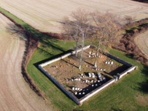
The historic Penns Neck Cemetery is located on the campus of Princeton University and contains at least 62 marked interments with dates ranging from 1749 to 1941. A stone wall surrounding the cemetery incorporates a cornerstone marked with the year of 1876, presumably the construction date for this gated enclosure. As the stone wall post-dates the interments within the cemetery, Princeton University was concerned with the potential for unmarked graves to be located outside of the marked cemetery bounds. The geophysical survey consisting of ground penetrating radar on the exterior of the stone cemetery wall revealed soil anomalies but could not conclusively identify them as burials due to soil conditions at the site. Mechanical stripping of surface soils at the exterior of the stone cemetery enclosure was recommended, followed by careful examination of the soils by trained archeologists to ground-truth results of GPR survey, to avoid the possibility of disturbing human remains inadvertently during planned campus construction.
Archeological and Geophysical Investigation of the Cherry Hill Cemetery (PG: 69-21, 18PR381) with a Maintenance and Management Plan, Prince George’s County, Maryland

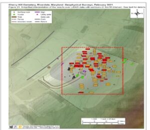
Cherry Hill Cemetery is a county-owned historical site located within the Beacon Heights subdivision in Prince George’s County, Maryland. The MNCPPC requested an archeological assessment to aid in their development of long-term land use planning for the cemetery property. The archeological assessment synthesized historical research conducted by MNCPPC historians, prepared a cut/fill analysis documenting modifications to the terrain over time, and included a geophysical investigation of the property to determine the number and location of interments at the cemetery. The GPR survey resulted in the identification of 33 probable burials and 74 likely burials. A management plan was prepared for MNCPPC to protect the gravesites from maintenance activities as well as damage from park use.
Cemetery Delineation, Excavation, and Relocation of the Kramer-Jacobs Cemetery (18FR847), Frederick County, Maryland

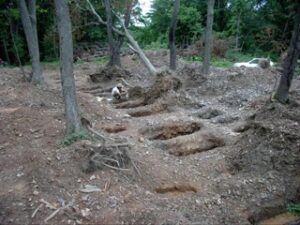
At the request of a property owner that intended to build a residence on a portion of an 86-acre tract, The Ottery Group conducted historical research and a reconnaissance walk-over of the project area. The research determined that the cemetery was associated with the Kramer and Jacobs families dating to the first half of the nineteenth century. After providing technical assistance to the property owner in obtaining permits for the removal of the burials and working with Frederick County planning and historic preservation staff, a plan was developed to exhume human remains from the project area for reinterment on another portion of the property. Archeological fieldwork for the cemetery relocation included the monitored mechanical removal of the upper two feet of soil to identify the presence of grave shafts. The mechanical stripping resulted in the identification of a total of 29 burials. Hand excavation of the burials consisted of the gradual removal of redeposited fill from the grave shafts. No laboratory analysis was conducted on the remains recovered from the cemetery. Cursory analysis was based upon types of coffin hardware and the observable condition of the remains in the field. Individual burials, once exposed, were mapped and photographed in place. The headstones and footstones were replaced in the same layout as they originally appeared and all material from the graves, including coffin nails, was reinterred with the skeletal remains.
Military Sites and Resources

Military archeology is the investigation and analysis of military sites such as battlefields, military camps, and fortifications to understand military events and the daily lives of soldiers. It uses a combination of archival research and field methods such as metal detecting survey, geophysics/remote sensing, and archeological excavation to uncover information that sheds light on historical accounts, such as troop movements, battlefield engagements, and military camp life.

Pre-Construction Planning Study for the Facilities Management Complex at the Virginia Institute of Marine Science, Gloucester County, VA

The Ottery Group served as cultural resource consultant to RRMM Architects for the development of a Facilities Management Complex at the VIMS campus. The one-acre portion of campus contains an intact portion of a Confederate star fort, as well as several domestic cellars associated with the Colonial-era town of Gloucestertown. The project involved the archeological and geophysical survey of the project area, the synthesis of data from prior archeological investigations within the project area, and the preparation of recommendations for mitigation prior to construction activities.

Archeological Investigations and Historic Landscape Study, Benedict, MD

For the Maryland State Highway Administration, The Ottery Group completed several task orders associated with a long-term archeological and historic landscape study near the Town of Benedict, in Charles County, MD. The initial task focused on a search for the British encampment during the lead-up to the 1814 attack on Washington, DC during the War of 1812. The project also focused on locating evidence of Camp Stanton, a Civil War-era training camp for African American slaves and freemen who would become members of the United States Colored Troops. Subsequent phases of the landscape study uncovered archeological resources dating from the 17th century associated with an early Colonial Period farmstead believed to be directly attributed to the Lord’s Baltimore landholdings, as well as an extensive Woodland Period settlement that contains a variety of lithic and ceramic artifacts and intact cultural features.

Survey of the Princeton Battlefield at the Institute for Advanced Study, Princeton, NJ

The Ottery Group conducted a geophysical and archeological survey, including metal detector survey and mapping, of Maxwell’s Field on the Princeton Battlefield. The battle was a pivotal 1777 engagement in the Revolutionary War. The IAS intended to use this portion of the campus for the construction of faculty housing. In addition to the reconstruction of the battle based on the distribution of dropped and fired musket balls, grapeshot and other munitions, protein residue analysis indicated the presence of human blood protein on several fired musket balls and horse blood protein on a bayonet. The project also included the coordination of permanent artifact curation with the New Jersey State Museum. A significant component of the project involved providing expert testimony at various public hearings, affidavits for legal proceedings, and press briefings during a highly-contentious portion of the construction project that affected a key portion of the Princeton Battlefield.

Documentation of Civil War Earthworks at the Virginia Central State Hospital, Petersburg, Virginia

The Ottery Group assisted the Virginia Department of General Services with historic resource documentation for Fort Baldwin. The initial archeological survey documented Civil War-era resources associated with the defenses of Petersburg, including remnant defensive trenchworks (44DW0596) extending to the north from Ft. Baldwin (44DW0589) and a possible gun battery (44DW0595) which were within the limits of disturbance for planned new hospital construction. These Civil War features are elements of the Confederate defenses surrounding Petersburg that were involved in combat during the terminal phase of the Siege of Petersburg in April 1865. The historic resource report incorporated historical records, maps, and other materials to document the Civil War fort and associated earthworks and other military features that are associated with the historic landscape. Fieldwork included metal detecting in blocks and non-invasive geophysical methods to estimate the horizontal and vertical boundaries of the resource. The resource report contained a thorough inventory of existing conditions and an accurate base map that provided clear graphic information about the location, complexity, physical context, and condition of the military earthworks system.

Archeological Services in Support of Clearing and Stabilization Activities at the San Fernando Bastion in San Juan National Historic Site, San Juan, Puerto Rico

The Ottery Group conducted archeological monitoring in support of vegetation clearing and stabilization of the cliff at the San Fernando Bastion in San Juan National Historic Site (SAJU) in Puerto Rico. The fortification system is the oldest European construction under United States jurisdiction and one of the oldest in the New World. The national historic site was designated a UNESCO World Heritage Site in 1983. The west shore of the Castillo San Felipe Del Morro is affected by significant gravitational erosion caused by wind, constant rain, water salinity, and wave action. The stabilization effort was designed to stabilize the cliff at San Fernando Bastion, which forms part of the foundation and support for the Castillo’s esplanade. Unexploded ordnance (UXO) was an issue of concern at the esplanade and at the San Fernando Bastion area. The project was managed by the Army Corps of Engineers via an Inter-Agency Agreement with the National Park Service. The archeological investigation was designed to assist the NPS with obligations under Section 106 of the National Historic Preservation Act (NHPA).

African-American Heritage Projects

African-American heritage projects are aimed at documenting and preserving the diverse history, culture, and identity of people of African descent in the United States.

These may include the documentation of sites of enslavement and the re-examination of historic sites with slavery histories, including former plantations. These projects also extend to the preservation and interpretation of historic sites and landscapes from post-Emancipation through the Civil Rights era. Often there is an element of civic engagement associated with the legacy of marginalization and erasure; such collaborative projects highlight the importance of interdisciplinary work.

Bridging the Centuries: Legacy of Slavery, Segregation, and Community Heritage at Booker T. Washington National Monument (BOWA)

In partnership with the National Park Service, The Ottery Group conducted a two-year study at Booker T. Washington National Monument (BOWA) in Hardy, Virginia. The investigation consisted of three components related to the life and legacy of Booker T. Washington and the evolving context of race in American society: 1) to evaluate likely locations for houses or quarters associated with the enslaved (Year 1) and activities associated with post-emancipation landscape and operation of the Colored school (Year 2), 2) to conduct archeological field survey of these identified areas, and 3) to facilitate and conduct community outreach and host workshops to foster public discussion about the histories of enslavement and segregation represented in the resources at the park. The project was broadly designed to assist the NPS with obligations under Section 110 of the National Historic Preservation Act (NHPA), specifically to ensure that historic preservation is fully integrated into interpretive programs.

African American Historic Sites Inventory for Prince George’s County, Maryland

The Ottery Group was awarded this contract through a competitive bid process from the Prince George’s County Planning Department to identify, evaluate, and record sites of significance in African American history in Prince George’s County, Maryland. The project was a continuation of research on African American historic sites in the county that began in the early 1990s by the M-NCPPC’s history division. The project entailed the completion of 70 MIHP forms for historic sites that included cemeteries, churches, schools, dwellings, commercial buildings, and other resources that are significant for their importance as constituting the African American social fabric of the county. Of particular importance was the inclusion of an oral history component to the resource documentation effort. The memories of living African American residents have proven to be a highly important component of assessing the significance of places associated historically with African Americans.
Wilson Road Historic Survey and Context Development

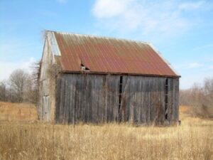
The Calvert County Historic Preservation Commission awarded The Ottery Group a contract to survey African American historic sites and to develop a historic context for the Wilson Road community, a rural, traditionally African American part of the county. This project was part of a larger effort to describe and preserve memory, sites, landscapes, and structures related to tenant farming and sharecropping from the end of the Civil War to 1950. The project focused on the community along Wilson Road, including Plum Point Road to its terminus at the Chesapeake Bay, and Emmanuel Church Road. Since the late seventeenth century Europeans, Euro-Americans, and African Americans have lived in the Wilson Road area. Their history can be seen in the remaining Civil War-era barns, eighteenth and nineteenth-century farmhouses, tenant houses, and other structures within the community. The project contributed to the Maryland Inventory of Historic Properties (MIHP) as well as the oral history and photographic collections in the county.
Historical Study and Archeological Evaluation of Gravesites at Fort Ward Park, Alexandria, Virginia

Fort Ward in Alexandria, Virginia, is one of the “Civil War Defenses of Washington,” a ring of manned earthen fortifications constructed during the Civil War to protect Washington DC from Confederate attack. Following the end of the Civil War, these fortifications were abandoned as military structures and several became foci for burgeoning black communities. The community known as “The Fort” contained several houses, a church, and a school. In the early 1960s, as part of the City of Alexandria’s plans to restore Fort Ward for the Civil War centennial, the land was seized through eminent domain and razed. The Ottery Group completed a multi-year project involving archeological, architectural, and historical research and field study. The primary focus of the archeological fieldwork included the location of family gravesites and the delineation of the Oakland Baptist Church cemetery, located within the park boundaries. The descendant community associated with The Fort had been active in its advocacy for recognition, specifically for gravesites that had been lost during the construction and operation of Fort Ward Park. Through a combination of mechanical and hand excavation, 23 previously unmarked graves were identified.

Historical and Archival Research

Background research is an essential component to understand the potential for a development tract to contain historic resources and archeological sites prior to field investigation. It involves a review of previous technical reports, historical records, maps, and other relevant sources of property data to identify whether known archaeological sites or historic buildings exist in a project area. Historic contexts are the foundation for understanding why properties have significance within the broad fields of history, architecture, archeology, or culture.

Historical research involves the review and analysis of primary and secondary historical sources that frame the specific resource within broader historical themes and allow for the evaluation of whether a property has an association with historical events, people significant to our past, architectural style, or the potential to yield important archeological or historical data.

Archival research is the systematic investigation of records, including primary source documents, deeds, government records, and other historical sources that contribute to the understanding of a property or event.

Antebellum Plantations Research Guide for Prince George’s County, Maryland

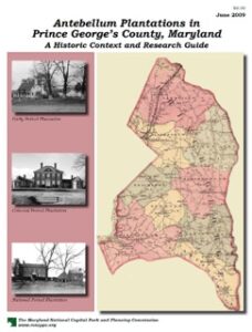
The M-NCPPC awarded The Ottery Group a contract to develop an Antebellum Plantation Research Guide for Prince George’s County. A substantial component of this guide was the creation of an agricultural context for the county in the period from 1696 to 1860. In addition to the preparation of the agricultural context, the project included a literature review and annotated bibliography of pertinent secondary literature focused on slavery and the African Diaspora, and African-American lifeways during the seventeenth century to the end of the Civil War. The project also included an analysis of plantation layouts from the period, including an assessment of the relationship between landscapes, structures, and human activity. The final document is routinely used by researchers and planners in the development review process, as well as for providing a baseline for assessing the significance of various antebellum resources in the county.
Historic Context for Rye Whiskey Production in Maryland, Sagamore Spirit

Kevin Plank, founder of Under Armour, created Sagamore Spirit Distillery in Baltimore, and wanted an answer to a simple question: did commercial rye whiskey distilling in Maryland predate whiskey production in Kentucky and Tennessee, and if so, what were the factors that led to successful commercial production? The Ottery Group carried out archival research pertaining to the historical origin and context of rye whiskey production in Maryland, focusing on the earliest appearance of distilling prior to the clear historical establishment of commercial distilling and subsequent popularity of this liquor. The Ottery Group produced a historic context and original research on the theme of distilling, consumption, and trade in rye whiskey in Maryland from approximately 1650-1800, using published and original documentary sources. The context contributed to the interpretive exhibit at Sagamore Spirit and allowed the distillery to “reclaim the city’s rightful place in America’s whiskey history, where storied distillers perfected rye whiskey for more than 150 years before Kentucky was founded.” In 2023, the Maryland legislature designated rye whiskey as the state’s official liquor.

African American Census Research for the Sandy Spring Museum, Montgomery County, Maryland

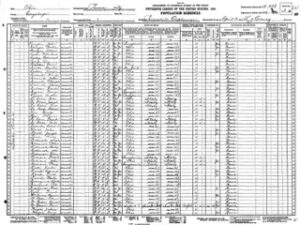
The Sandy Spring Museum requested the compilation of census records for three census districts from 1790 to 1920, with sufficient analysis to identify African Americans within the record sets. The project was designed to develop a database that would facilitate future research efforts. Census and other population records from 1790 to 1864 were used to identify slaveholdings within the selected census districts. Historical slave censuses and schedules, and probate records typically omit surnames of enslaved people, and comparison with the post-bellum U.S. Censuses matching first names, household members, ages, and geographic data was used to inform attempts to identify surnames of people enslaved in the study area prior to the end of slavery in Maryland on November 1, 1864. The data for African Americans identified through the census records and other sources were compiled into a digital database. A technical report was also prepared to provide an analysis of major trends in the data and develop a historical context for African American individuals and households within Montgomery County.
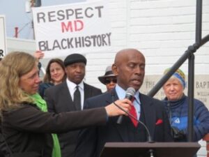
Cemetery Assessment for the Westbard Sector Redevelopment, Bethesda, MD

The River Road Moses Cemetery is located in Bethesda, Maryland on a parcel of land deeded in 1911 to an African-American fraternal organization that functioned as a churchyard and cemetery. It was purchased for development in the mid-1960s after most of the African-American residents of the River Road Community had been displaced by subdivision development. A multi-story apartment building and parking lot now occupy much of the parcel. The Ottery Group was contracted to prepare an assessment of the property to determine whether it was used as a cemetery, and to determine the likelihood of encountering burials during proposed construction of a new parking facility. The Ottery Group prepared an analysis of documentary sources to assess the probability that the cemetery contains intact burials and/or human remains in disturbed contexts. The Ottery Group carried out consultation with Montgomery County’s planning department, as well as a community of descendants and advocates for the preservation of the cemetery, performed extensive archival research, and prepared a technical assessment with recommendations on the likely disposition of the cemetery.
Collections and Museum Exhibits

Artifact collections are the unique and irreplaceable result of archeological investigations and, in many cases, are all that remains of an archeological site after it is lost to development. Thus, most archeological collections are permanently curated at state or federal repositories in order to make these collections accessible to research. Archeological collections include objects (artifacts, soil samples, etc.), associated documentation (field records, photographs, maps, measured drawings, archeological catalogs, and digital data), as well as technical reports. Conserved artifacts are often provided on loan to museums for display. In addition, archeological research and analysis are often used to create engaging narratives for museum exhibits. Research conducted for regulatory requirements also leads to the development of historical signage for erection in public spaces and interpretive print and media content to promote heritage tourism

123

123

123

123

123

GIS, LiDAR, and Photogrammetry Mapping

There are a variety of technological innovations for mapping and modeling that are useful to historic resource documentation. Geographic Information Systems (GIS) integrates maps and databases in order to record, analyze, and visualize spatial data, and is useful for understanding site layouts on a landscape, predict undiscovered sites, model landscape change, and perform complex spatial analysis to reveal patterns of past human activity. Photogrammetry is the use of an optical camera that photographs with significant stereoscopic overlap in order to measure the ground surface through what is essentially trigonometry. Specialized software analyses the overlapping images and finds clusters of pixels that they share in common - making a 3D "point" in virtual space. It does this millions of times to make a "point cloud" representing a 3D map of the terrain. LiDAR uses lasers for direct, highly accurate geometric mapping, excelling in dense vegetation where photogrammetry is not as effective.

Germanna Community College, Locust Grove Campus Master Plan, Orange County, VA

The Ottery Group served as cultural resource lead on a team led by RRMM Architects for the development of a Master Plan for the 100-acre Locus Grove campus. The campus contains Civil War earthworks associated with the Wilderness and Chancellorsville Battlefields that bisect the campus. The Master Plan provided for the preservation and interpretation of the Civil War resources, and also accommodated the needs for systematic survey and evaluation of undeveloped portions of the campus.

Public Engagement and Collaboration

Public interpretation is one of the most effective tools to tell the stories of our past. The Ottery Group has designed and implemented public education programs involving archeology and has conducted interpretive projects for museums, historic foundations, and other parties. The Ottery Group regularly participates in public hearings and community meetings, and organizes Tribal, & Descendant Community meetings to foster project collaboration. The firm’s senior staff are routinely invited to serve as guest lecturers or speakers at community events. Most of our technical staff are active in professional organizations and routinely present papers at professional meetings.

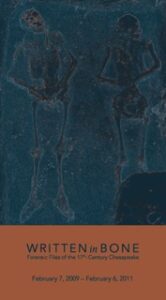
Artifacts and Content for the Smithsonian Institution’s “Written in Bone” Exhibit

The Smithsonian’s “Written in Bone: Forensic Files of the 17th-Century Chesapeake” was a popular museum exhibit at the National Museum of Natural History (2009-2014) that used modern forensic anthropology and archeology to interpret the stories of early colonists in the Chesapeake region. The exhibit featured human remains, burial artifacts, and forensic reconstructions from the early Chesapeake to reveal details about health, labor, disease, and burial practices. The Ottery Group’s investigations at the colonial port town of Gloucestertown on the York River of Virginia attracted interest from the Smithsonian curators designing the exhibit, specifically for two burials excavated during the project. The two graves were part of a small cemetery area that appears to have been used to inter servants that died soon after arrival to the port town. The graves were for a white female, buried in an east-west (Christian) orientation, and a female of African descent, buried in a north-south orientation. Both burials have a date range of 1640-1680 and represent some of the earliest remains of individuals associated with the servant class. Analysis of carbon isotopes in the bone matrix indicated that both females died within a short time after arrival to Gloucestertown. Bead and shell artifacts found in direct association with the African burial were incorporated into the Written in Bone exhibit; these artifacts are now housed at the Smithsonian Museum of African American History and Culture.
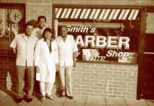
Solving a Historical Mystery: Archeological Investigation of the “Mount Hope Slave Quarter” in Cheverly, Maryland

At the request of the MNCPPC, archeological testing was conducted at the “Mount Hope Slave Quarter” (PG:69-25) in Cheverly, Maryland. The site has a presumed association with the Mount Hope Plantation (HS:69-11) and is located approximately 400 feet from the plantation house. The 716-acre Mount Hope Plantation was established circa 1839 and is historically associated with the Magruder family. The plantation held 15 enslaved persons in 1840, 18 in 1850, and 25 in 1860. It has been presumed that the extant chimney was part of a dwelling for the enslaved dating to the period between 1840 and 1860. The ruin is located in the rear yard of a private residence. The archeological investigation indicated that the construction of the chimney occurred post-1870, and therefore was not associated with housing for the enslaved.

Oral Histories for the African American Historic Sites Inventory, Prince George’s County, Maryland

The Ottery Group was awarded this contract through a competitive bid process from the Prince George’s County Planning Department to identify, evaluate, and record sites of significance in African American history in Prince George’s County, Maryland. The project was a continuation of research on African American historic sites in the county that began in the early 1990s by the M-NCPPC’s history division. The project entailed the completion of 70 MIHP forms for historic sites that included cemeteries, churches, schools, dwellings, commercial buildings, and other resources that are significant for their importance as constituting the African American social fabric of the county. Of particular importance was the inclusion of an oral history component to the resource documentation effort. The memories of living African American residents have proven to be a highly important component of assessing the significance of places associated historically with African Americans.
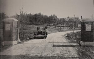
Recording a “Lost” Cemetery: Delineation of the Higgins Cemetery, Rockville, Maryland

The Higgins Cemetery is located on a small parcel within a cluster of light industrial buildings in Rockville, Maryland. James Higgins settled here in the 18th century after serving in the Continental Army during the Revolutionary War. When he died in 1816, he was buried in a small cemetery plot, as were many of his descendants until the land was subdivided in the late 19th century. By the mid-20th century, the surrounding area had largely become industrial, and although the cemetery plot was not developed, it had become a trash dump until descendants of the Higgins family received a quitclaim deed in order to restore the cemetery. The Ottery Group provided technical assistance, equipment, and labor on a pro-bono basis to Peerless Rockville and the Daughters of the American Revolution. The initial steps included an inventory of existing monuments that had been removed from the cemetery and the field mapping of graves based on a 1927 sketch map of the cemetery. The archeological fieldwork at the Higgins Cemetery was aimed at determining whether gravesites, other than those already marked, were present in the cemetery area. To identify and map gravesites, mechanical stripping of the surface soils was conducted to locate grave shafts in the subsoil. A map of the Higgins Cemetery was prepared to guide the eventual restoration of the cemetery as a contemplative park.

National Register of Historic Places (NRHP) Evaluations and Nominations

The National Register of Historic Places is the nation’s official list of cultural resources worthy of preservation. Authorized under the National Historic Preservation Act of 1966, the National Register is part of a national program to coordinate and support public and private efforts to identify, evaluate, and protect historic and archeological resources. Properties listed in the National Register include districts, sites, buildings, structures, and objects that are significant in American history, architecture, archeology, engineering, and culture.

National Register properties are distinguished by having been documented and evaluated according to uniform standards. These criteria recognize the accomplishments of all peoples who have contributed to the history and heritage of the United States and are designed to help state and local governments, Federal agencies, and others identify important historic and archeological properties worthy of preservation and of consideration in planning and development decisions.

The Ottery Group has conducted archival reviews, literature searches, and other types of research associated with preparing National Register Nomination forms.

Architectural Survey and Historic Preservation Planning, City of Hampton, Virginia

The Ottery Group was awarded a project through the Virginia Department of Historic Resources Cost Share Program to complete a historic resources survey of neighborhoods in the City of Hampton and to prepare National Register nominations for two historic districts in the city. The project involved a survey of nearly 1,700 individual resources in the Old Wythe and Pasture Point Historic Districts. These neighborhoods were developed after 1880 and were linked historically with the streetcar suburb era. The local communities were actively involved in the project. The Ottery Group also conducted public information meetings for the public to highlight the project and explain the results. Each property surveyed was recorded on a reconnaissance level, including photographic documentation, property descriptions, sketch plans, and mapping. This project was awarded as a follow-up to an earlier contract completed under DHR’s Cost Share program that included other areas of the City of Hampton and also included a survey of architectural resources in Southampton and James City Counties.

Cheverly Community Survey and National Register of Historic Places Nomination, Prince George’s County, MD

The Ottery Group conducted an architectural survey and prepared a National Register nomination for seven of the originally platted parcels within the historic core of the Town of Cheverly. Following the successful listing of the historic district on the National Register, the MNCPPC requested the expansion of the community survey and revision of the National Register nomination for the Town of Cheverly. Specifically, the district boundary was expanded to include all property located within Cheverly Sections 1 through 11, as well as the adjacent subdivisions of Cheverly Forest, West Cheverly, and Dickey’s Addition to Englewood. The nomination revision/expansion accommodated the request of the town and stakeholders that the National Register district boundary include land and resources that represent the historic diversity of the community. Particular attention was placed on critical aspects of the nomination to ensure the adequate documentation and recognition of Cheverly’s African American Fourth Ward neighborhood.
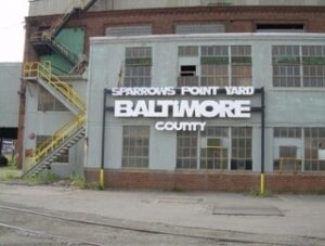
Historic Preservation/Section 106 Consultation, Sparrows Point Shipyard Historic District, Baltimore, MD

The Ottery Group served in the lead role for the historic preservation effort associated with the development of a proposed LNG Terminal at the former Bethlehem Steel shipbuilding complex at Sparrows Point in Baltimore, Maryland. The tract was formerly part of a Bethlehem Steel complex used between 1889 and the early 1990s for manufacturing steel and shipbuilding. The firm’s responsibilities included the completion of various Section 106 components, including determining the project’s Area of Potential Effects and consultation with the Maryland SHPO. The initial effort also involved the identification of the Sparrows Point Shipyard Historic District. The shipyard was significant for its role in early steel operations and for its role in shipbuilding for the United States military during World Wars I and II. The historic property consists of approximately 80 acres of industrial buildings, infrastructure, and shipways used for the construction, repair, and decommissioning of large ships. The shipyard was determined eligible for listing in the National Register of Historic Places. Following the eligibility determination, The Ottery Group prepared an Assessment of Effects, including the evaluation of direct effects to the Sparrows Point Shipyard District as well as indirect effects to historic properties in the surrounding area. The final element of the consultation effort involved the development of a mitigation strategy to resolve adverse effects to this significant industrial site.
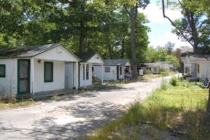
Section 106/Historic Preservation Compliance Services, Nazarene Camp Property, Cecil County, Maryland

The Ottery Group completed a Determination of Eligibility for the North East Nazarene Camp (CE-1553) in Cecil County, Maryland. The planned redevelopment of the property required the issuance of a wetlands permit from the Army Corps of Engineers (COE) which triggered compliance with Section 106 of the National Historic Preservation Act. The 61-acre church camp included 208 lodgings, tent and RV camp sites, hotels, nursery buildings, three tabernacles, a dining hall, and additional buildings associated with the various functions of the church camp. The property was determined eligible for listing on the National Register of Historic Places as a significant example representing social and religious traditions which began in the eighteenth century as well as a distinctive characteristic of a type and period of camp architecture. The Assessment of Effects determined that the proposed development would have an adverse effect on the historic camp. Following the adverse effects determination, The Ottery Group worked with the developer, the COE, and the Maryland Historic Trust to prepare a Memorandum of Agreement (MOA) to mitigate adverse effects to the Nazarene Camp property from the proposed development.