 Phase I Archaeological Surveys for the Southwestern Power Administration (SWPA), Oklahoma and Arkansas
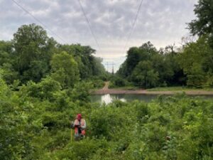
The Southwestern Power Authority (SWPA) operates and maintains 1,380 miles of electrical transmission lines and substations, largely in Missouri, Oklahoma, and Arkansas. The Ottery Group has completed several archeological surveys associated with planned utility corridor upgrades: an archeological survey for the Piggott Substation, Arkansas (2021), Line 3001C Survey, Oklahoma and Arkansas (2022), Line 3101 Survey, Oklahoma (2023), Line 3101 Continuation Survey, Oklahoma (2024), Line 3005, Oklahoma (2024), Line 3007, Arkansas (2025). The projects consisted of identification-level survey and evaluation of identified sites within the rights-of-way using a no-collection strategy.
 Archeological Survey Associated with Scott’s Landing Road and Parking Lot Improvements at the Edwin B. Forsythe National Wildlife Refuge, Atlantic County, New Jersey
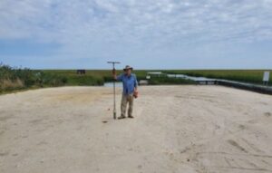
The Federal Highway Administration (FHWA) and United States Fish and Wildlife Service (USFWS) planned improvements at the Scott’s Landing Boat Ramp within the Edwin B. Forsythe National Wildlife Refuge (EDFO) in Galloway Township, New Jersey. The Ottery Group conducted a Phase I archeological survey of the project area in 2019. A total of 76 shovel test pits (STPs) were excavated within the project area using a staggered 8-meter interval testing grid. Two of the STPs yielded glazed redware vessel fragments, dating to the 19th century. One STP contained two fragments of Accokeek-like grit tempered pottery that dates to the Early Woodland period. A second phase (2020) of the project involved the widening of Scott’s Landing Road. The Ottery Group conducted a Phase I archeological survey along a segment of the road consisting of STPs on an 8-meter interval transect, with additional radial tests excavated around positive STPs. The survey identified a low-density scatter of mid-nineteenth century domestic materials. The historic artifacts were related to a former house site owned by Jonathan Sooy between 1841 and 1872. The site was designated the Sooy Scatter and was registered with the New Jersey State Museum (NJSM).
 Phase I Archeological Survey for the Smith Crossing Project, Prince William County, VA
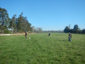
The Ottery Group conducted a Phase I archeological survey for the proposed Smith Crossing Development in Prince William County, Virginia. The planned single-family homes and townhouse development is located on three tracts of agricultural land associated with an active cattle farm totaling 234.8 acres. The archeological survey consisted of the excavation of shovel test pits excavated at 15-meter intervals, with additional radial tests to bound artifact concentrations. The project area is within mapped boundaries of Civil War military activity and also required Metal Detection Survey (MDS) to meet V-DHR identification standards. A total of 4 archeological sites were identified during Phase I survey. The historic architectural survey identified 12 structures within the project area that were over 50 years old. These resources were documented in V-CRIS. 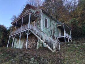 Archeological and Geophysical Investigations in Support of Multiple Historic Property Demolitions, New River Gorge National Park and Preserve (NERI), West Virginia
The Ottery Group completed a survey and evaluation of archeological components associated with 21 historic structures within nine distinct Archeological Survey Areas (ASAs) in the New River Gorge National Park and Preserve (NERI). The investigation included the archeological and geophysical survey of the ASAs and included the excavation of a total of 1,196 shovel test pits (STPs) excavated at five and ten-meter intervals around structures targeted for demolition. The archeological testing yielded a total of 4,492 artifacts, including 243 pre-contact Native American artifacts and 4,239 artifacts dating from the late 19th-20th century. The project resulted in the relocation and delineation of three previously recorded sites and the identification of six new sites. Geophysical surveys were conducted at seven ASAs. This integrated approach helped to map and characterize a range of cultural remains at each site, including historic foundations, features and other deposits.
 Cultural Resources Inventory and Evaluation of the Braestrup Property, Catoctin Mountain Park (CATO), Frederick County, Maryland
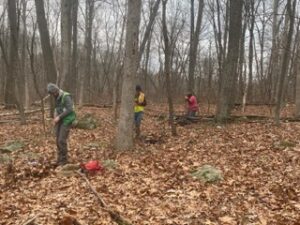
The Ottery Group completed an archeological investigation of the Braestrup Property within Catoctin Mountain Park (CATO). The archeological investigation was designed to assist CATO with obligations under Section 110 of the National Historic Preservation Act (NHPA) and the Archeological Resources Protection Act, specifically to inventory and evaluate archeological resources on the 72-acre tract prior to the preparation of a Cultural Landscape Inventory on the farm property. The fieldwork consisted of a pedestrian walk-over, STP survey, metal detection survey, geophysical survey, and photographic documentation of the agricultural landscape. The archeological survey included the excavation of 1,391 shovel test pits (STPs) excavated at regular intervals across the entire Braestrup property, supplemented with close-interval STPs and metal detecting within the location of former outbuildings in the core area of the farm. Geophysical testing, using ground-penetrating radar (GPR), was conducted across the open areas within the project area. Historic landscape documentation was prepared for the agricultural landscape and included documentation of two extant buildings. 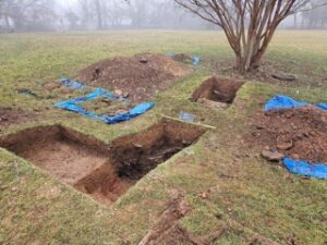 Phase I and Phase II Archeological Investigations for the Proposed Village at Clear Springs, Prince William County, VA
The Ottery Group completed a Phase I archeological survey at the location of a proposed residential development in the Town of Leesburg, Virginia. The proposed 245.95-acre development will contain residential housing units of various types, a church, community centers, green space, walking trails, and open public areas. Archeological fieldwork for the Phase I survey consisted of the excavation of 3,233 shovel test pits across the portions of the project area that will be impacted by the development. Archeological testing was conducted at 15-meter intervals, supplemented with close interval testing at potential site locations. The survey resulted in the identification of eight previously unidentified archeological sites. Three of the sites are low density lithic scatters situated on terraces above Sycolin Creek; one site is a dispersed scatter of lithic debitage; one site is a cluster of artifacts that appear to be associated with a 19th-20th century outbuilding; one site is a domestic artifact scatter with material from the 18th-19th century; and two sites are 19th-20th century domestic sites, one of which also contains a pre-contact seasonal camp component that dates to the Middle to Late Archaic period. Phase II evaluations were conducted at two of the identified sites, 44LD1981 and 44LD1987, in order to determine their potential National Register eligibility. 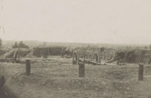 Phase II Archeological Evaluation of Site 44DW0592 at the Virginia Central State Hospital, Petersburg, Virginia
The Ottery Group assisted the Virginia Department of General Services with Phase II site evaluation of a dwelling associated with Central State Hospital. The initial archeological survey identified a variety of archeological resources associated with the operation of Central State Hospital from c.1885 through the 20th century. A domestic structure (44DW0592) was one of several hospital-related archeological resources that are contributing elements of the Central State Hospital Historic District. Fieldwork associated with the site resource evaluation of 44DW0592 involved the excavation of a series of close-interval shovel test pits (STPs) within the site boundaries, and the excavation of 1×1-meter excavation units to collect more refined data within a more controlled context. 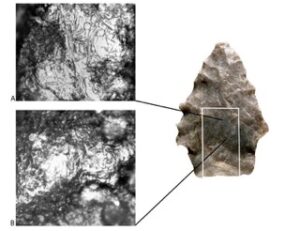 Phase III Archeological Data Recovery for the Dulles Corridor Metrorail Project, Loudoun County, Virginia
The Ottery Group served as prime contractor for the data recovery effort at 44LD1596 for the expansion of the Metrorail system to service Dulles Airport. The excavations yielded more than 8,000 artifacts, paleobotanical samples, 11 radiocarbon assays, and one intact Early Archaic period hearth feature. The temporally diagnostic projectile points span the Early Archaic through the Middle Woodland periods, a span that was mirrored by the results of the radiocarbon assays. The analyses provide a basic understanding of the nature of the Native American occupation at 44LD1596. Flotation samples from sub-plowzone deposits indicated that occupations consisted of small groups that were exploiting local resources—nut mast and game—although other resources, such as fruits, fish, reeds, and wood, were also exploited. 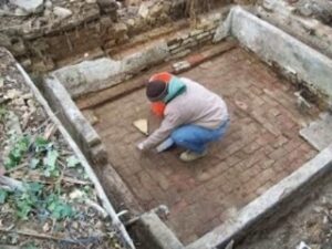 Archeological Data Recovery at the Salubria Plantation Site, Prince George’s County, Maryland
The Ottery Group completed archeological data recovery at the historic site of Salubria, an early nineteenth-century plantation in Oxon Hill, Prince George’s County, MD. The Ottery Group maintained close coordination with the consulting parties, as the data recovery investigation represented the final effort to recover and preserve archeological and historical data associated with this significant site. The site is associated with Dr. John Bayne, a notable nineteenth-century horticulturalist who is revered as the first to develop commercially sustainable tomatoes, strawberries, and other tree fruits. The public was engaged in the project and included an active preservation group of African American residents who viewed the site as highly significant in African American history and heritage. The project was completed under a very tight schedule to allow the construction of the proposed commercial shopping center. Artifact processing and preparation for permanent curation of the more than 18,000 artifacts was completed in a very short time following fieldwork. 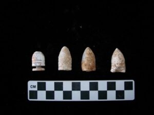 Archeological Assessment, Evaluation, and Mitigative Excavations at the Emory Church, Washington, DC
The Emory Beacon of Light (EBOL) is a community development organization established in 1996 as an outgrowth of the ministries of The Emory United Methodist Church. The congregation formed EBOL for a vision to construct a broad-range facility for community outreach using the historic church on Georgia Avenue as a base for the new facility. The project was subject to the regulations of the DC Historic Preservation Office as well as the historic architectural review board. An Archeological Assessment (2009), Evaluation (2015), and Mitigative Excavations (2017) were conducted at the property to satisfy these requirements. In addition to the preservation of the historic church, the property was the location of Fort Massachusetts, a precursor to Fort Stevens. The fort was part of a ring of defensive forts constructed during the Civil War to protect Washington, DC. The 2009 assessment identified the presence of extant fortification features associated with Fort Massachusetts as well as the foundation for the church parsonage constructed after the Civil War. In 2015, soil cores were extracted to confirm the stratigraphy associated with the fortification earthworks and to locate the bombproof and the original chapel that predates the Civil War. The study also included a geo-archeological assessment and GPR survey to identify subsurface features and assess the integrity of deeply-buried elements associated with the fort and earlier church buildings. In addition to the archeology associated with the Civil War fort, a significant amount of archeology was aimed at understanding the history of the church. Data recovery excavations were completed in 2017. A significant effort includes public outreach that included the preparation of a public-oriented book (2021) that focuses on the interrelated historical contexts of the Civil War fort, the Emory Church, and the Brightwood neighborhood. Native American Settlement Patterns within the New River Gorge National Park and Preserve (NERI), Fayette County, West Virginia
The Ottery Group completed an archeological survey of the Dowdy Creek watershed within the New River Gorge National Park and Preserve (NERI) in Fayette County, West Virginia. The study was conducted in order to locate, analyze, and interpret the spatial patterning of pre-contact Native American sites within the Dowdy Creek watershed, and to use Geographic Information System (GIS) to examine correlations between various environmental variables and archeological site locations. The archeological survey of the uplands consisted of pedestrian reconnaissance to locate specific landforms and the excavation of shovel test pits (STPs) to identify the presence of archeological sites. The rock shelter survey consisted of a reconnaissance of geological outcroppings at elevations associated with the Pineville and Raleigh sandstone formations with limited STP testing where soil was present. Sixteen archeological sites were identified in the upland survey area, including 14 open terrestrial sites and two rock shelters. The rock shelter survey identified 67 rock overhangs, niches, and caves that were determined to have the potential to have been used as rock shelters.
Phase III Archeological Data Recovery for the Dulles Corridor Metrorail Project, Loudoun County, Virginia
The Ottery Group served as prime contractor for the data recovery effort at 44LD1596 for the expansion of the Metrorail system to service Dulles Airport. The excavations yielded more than 8,000 artifacts, paleobotanical samples, 11 radiocarbon assays, and one intact Early Archaic period hearth feature. The temporally diagnostic projectile points span the Early Archaic through the Middle Woodland periods, a span that was mirrored by the results of the radiocarbon assays. The analyses provide a basic understanding of the nature of the Native American occupation at 44LD1596. Flotation samples from sub-plowzone deposits indicated that occupations consisted of small groups that were exploiting local resources—nut mast and game—although other resources, such as fruits, fish, reeds, and wood, were also exploited.
 Archeological Investigations for the Seneca Store Rehabilitation Project, Montgomery County, Maryland
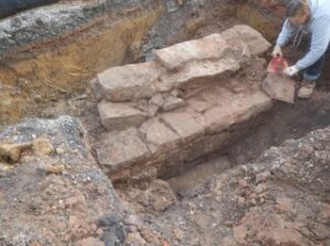
For the Montgomery County Department of Parks, The Ottery Group conducted an archeological investigation at the historic Seneca Store (also known as Poole’s Store) as part of several rehabilitation efforts to repair the structure and install new underground utilities. Archeological survey, monitoring, and test unit excavations were conducted. The investigation identified a rectangular stone feature that was determined to be the remnant of a mill wheel pit that had been filled with refuse. This feature represented a new archeological site that is distinct from the existing Seneca Store site (18MO732). Partial excavation of the filled feature revealed that the mill wheel pit feature was filled over a short time in the 1880s or early 1890s.
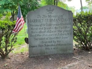 Phase I and Phase II Archeological Investigations at Thompson AME Zion Church, Harriet Tubman Historical Park (HART), Auburn, New York
The Ottery Group conducted an archeological investigation at the AME Thompson Memorial Church and associated parsonage in partnership with Harriet Tubman National Historical Park (HART). The Thompson Memorial AME Zion Church was designated a National Historic Landmark in 2001 for its association with American abolitionist and political activist Harriet Tubman. The archeological investigation was designed to document and evaluate archeological resources on the church property prior to the rehabilitation and restoration of the buildings as well as the installation of utilities and landscape features on the property. Archeological monitoring was also conducted during demolition activities within the cellar as well as areas on the exterior of the church and parsonage that were considered archeologically sensitive.
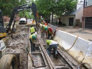 Archeological Monitoring, Evaluation, and Data Recovery for the O and P Street Rehabilitation Project, Georgetown Historic District, Washington, DC
The Ottery Group was awarded a contract as part of a team of companies assisting the District of Columbia Department of Transportation (DDOT) in complying with Section 106 of the NHPA relating to an extensive utility upgrade and surface reconstruction project in the Georgetown Historic District. The neighborhood contains NRHP and NHL properties and is one of Washington’s most notable historic neighborhoods. The Ottery Group project managers and senior field staff participated in regular coordination meetings between FHWA, DDOT, DC SHPO, and other parties. Public involvement included meetings with the neighborhood residents, project staff, and local political representatives to ensure that concerns were adequately addressed. Of particular concern was the restoration of historic brick sidewalks, slate curbstones, cobble pavers, and other character-defining aspects of Georgetown’s built environment. The Ottery Group archeologists worked closely with historical architects and construction crews to ensure that the recovery of brick and cobblestones was completed in accordance with the MOA. A major component of the field monitoring involved the preservation of historic rail tracks and associated components, which were related to the late-19th and 20th-century streetcar suburb era in Washington.
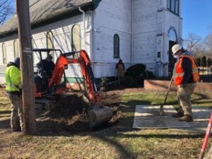 Construction Monitoring Associated with Utility Upgrades at the St. Ignatius Church Cemetery, Oxon Hill, Maryland
St. Ignatius is a Queen Anne-style church built in 1890 to replace the original 1849 church on the site. The church was listed in the National Register of Historic Places in 1974. A large cemetery adjoins the church. As part of planned construction associated with the bell tower restoration, the overhead service drop for utilities needed to be grounded. The construction was located in the cemetery area surrounding the church, and there was a significant potential to encounter human remains during the trenching activities. Mechanical stripping removed soils in a roughly six-foot wide area following the centerline of the proposed utility trenching. The stripped area was hand-troweled to map graveshafts and detect whether disturbed graves are present, which provided the opportunity to alter the utility route to avoid the disturbance of graves.
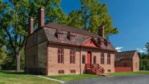 Geophysical Investigations to Document the Historic Landscape at Darnall’s Chance, Upper Marlboro, Maryland
The Ottery Group completed a geophysical survey of Darnall’s Chance (PG:79-028) in Upper Marlboro, Maryland. Darnall’s Chance was originally built ca. 1742 by James Wardrop, a prominent local merchant. Subsequent owners included a number of merchants. Several unique structures on the property were indicated in various archival records and historical accounts reflecting the use of the property for mercantile, rather than plantation, operations. Research also indicated that the property had a formal garden, a family burial vault, and that there were slave-related elements associated with the historic landscape. None of the outbuildings and landscape elements have survived. The geophysical survey served as a baseline study to document the eighteenth-century landscape associated with the property. The geophysical investigation was the initial phase of research aimed at broadly characterizing subsurface conditions associated with the tract, followed by the development of a synthesis of prior archeological research to enhance the archeological knowledge of the property, direct future archeological investigation, contribute to interpretation, and allow for more effective planning and site management at the property.
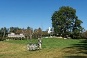 Geophysical Survey at Saint-Gaudens National Historic Site, Cornish, New Hampshire
The Ottery Group conducted a geophysical survey at Saint-Gaudens National Historic Site (SAGA) in Cornish, New Hampshire for the National Park Service (NPS). Non-invasive, high-resolution magnetometer and ground-penetrating radar (GPR) surveys were conducted at two locations at SAGA: the Aspet Unit and the Blow-Me-Down Farm Unit. The primary aims of the investigation were to locate and map buried cultural remains and utilities at each location in preparation for the replacement of utility lines and planned building rehabilitation.
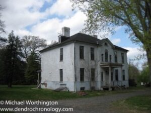 Archeological Investigations and Geophysical Survey, Compton Bassett Historic Site
The Ottery Group conducted archeological investigations at the Compton Bassett Historic Site (PG:79-063-10) in Prince George’s County, Maryland under contract with the M-NCPPC Prince George’s County Parks program. The investigation was conducted within the approximately 2-acre historic core of the plantation property as part of the planning process to stabilize several historic buildings and structures at the site. The scope of work included both invasive (excavation) and non-invasive (geophysical) methods to identify and evaluate historic archeological features associated with the eighteenth-century formal plantation landscape surrounding the main house. A geophysical survey of the core area included ground-penetrating radar (GPR), magnetometry, and magnetic susceptibility. The investigation was successful at identifying intact archeological resources associated with structural and landscape changes at Compton Bassett spanning the period from c.1700 through the late-twentieth century.
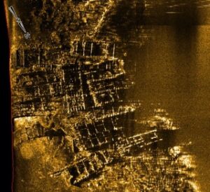 Underwater Investigations Associated with the Dyke Marsh Wetlands Restoration Project, Mclean, VA
The Ottery Group and Geomar Research completed an underwater remote sensing survey on the western shore of the Potomac River as part of the Dyke Marsh Wetlands Restoration Project. Dyke Marsh is part of the George Washington Memorial Parkway (GWMP) managed by the National Park Service (NPS). The US Army Corps of Engineers planned to construct shoreline structures to stabilize the existing marsh and foster the development of new marsh. Two shipwreck areas were identified within the project area during the side scan sonar survey, which were determined to be the remains of 19 barges associated with historic sand and gravel mining activities that began in the 1930s and continued into the early 1970s. The Phase II evaluation determined that all nineteen barges were similarly constructed and represented typical industrial watercraft of the early to mid-20th century that were abandoned at the time after their useful life was over.
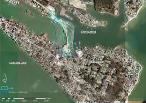 Underwater and Terrestrial Archeological Survey for the Replacement of the Maryland Highway 254 Bridge over Neale Sound, Charles County, MD
The Ottery Group completed an identification-level survey of prior to the replacement of a bridge linking the Cobb Island community in Charles County, Maryland with the mainland via MD 254. An underwater remote sensing survey was carried out by Geomar Research, which consisted of the collection of side scan sonar, magnetometer, and sub-bottom profiler data. The underwater survey identified a number of anomalies, including the remains of a 17.5-foot skiff, a 25-foot modern sailboat, and an unidentified wooden vessel. The project was completed under contract with the Maryland State Highway Administration.